Public product
Seismic & volcanic viewers
Interactive visualization of geoscientific data.
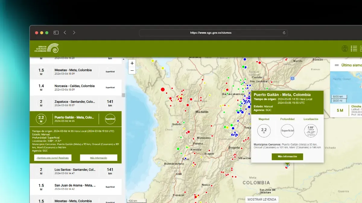
The public earthquake and volcano viewers of the Colombian Geological Survey: interactive maps and large historical datasets made navigable.
Context
The Colombian Geological Survey monitors seismic and volcanic activity across the country. That information is of public interest, and it needed public interfaces to consult it.
Problem
There was no product yet: everything had to be built from scratch, and the data ranged from the latest event of the day to decades of historical records.
Constraints
- A very wide audience: from citizens checking the last earthquake to researchers querying historical series.
- Large data volumes on a map, where every extra rendered layer costs responsiveness.
- Public, institutional traffic: it has to hold up exactly when an event happens.
The work
- Built the earthquake and volcano viewers from scratch, with interactive maps and detail views per event.
- Made the data explorable through search, filters, sorting, charts and tables over the same dataset.
- Developed a historical catalog with search, filtering and pagination over long time series.
Decisions
- One data model behind several representations — map, chart and table — instead of separate screens with separate logic.
- Filtering and pagination on the data layer, so the map never has to render more than it can handle.
Result
Public products that expose large amounts of geoscientific information in a way that is navigable and useful for very different kinds of user.
Learnings
- My frontend foundations were built here: interface design, state, data handling, performance and reuse, without relying on tooling to think for me.
- Building something public teaches a different kind of discipline: someone always needs it to work today.